Whether you live in a city or enjoy visiting one, you might have a major complaint: the sheer amount of traffic. And the city in question doesn’t have to be a huge one, like New York City or Houston; even smaller cities, like Des Moines, Iowa, or Tuscaloosa, Alabama, experience these issues. So, why is this the case? Much of it boils down to our approach to urban planning.
For one, urban planners have designed both cities and towns with personal vehicles in mind rather than people. While personal vehicles do afford mobility and accessibility in many otherwise isolated locations, there are clear drawbacks, too. In fact, sometimes the roadways and other urban developments that come along with designing with cars in mind actually lead to both less mobility and accessibility.
Urban Planning, Explained: Yes, Cars Are Making Cities Less Accessible
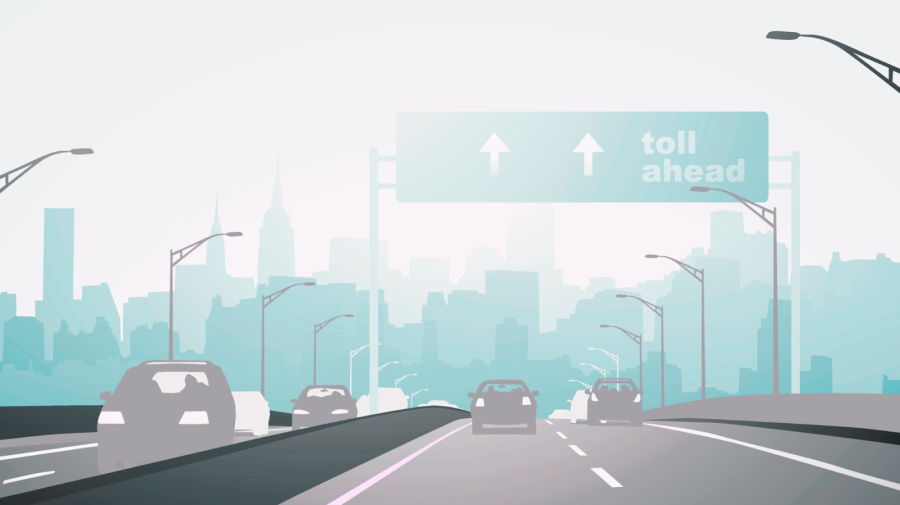
Imagine driving down one of the main roads in your city or town. You see a place you want to visit — let’s say, a local ice cream shop — and there’s even a parking spot available right outside. Except, it’s rather difficult to maneuver your vehicle to the outside lane and park given the traffic.
So, you drive around the block, making sure that you’re in the correct lane to snag the parking spot this time. Once you circle back, though, that prime parking spot is gone. You could circle the block in search of another spot, find something a few blocks away from the ice cream shop or park in a garage or lot within walking distance. But, no matter your choice, it’s kind of frustrating, isn’t it?
Of course, a lack of parking doesn’t just impede your ice cream run. If you need to stop in at the bank or grocery store, you may have encountered a similar scenario. While you can walk a bit, it’s not always the safest option, especially in areas that are built for cars in mind. If you’ve ever walked along a busy street without a sidewalk, you know what we mean. In short, our cities and towns are car-centric — they simply aren’t designed with pedestrians, public transit or bicycles in mind.
While taking a rideshare or hopping in your car may seem like the easiest, fastest way to get somewhere, mobility actually suffers if there’s a sea of cars all the time. It’s not only harder (and potentially less safe) for people to walk or bike, but it also hampers the efficiency of public transportation.
Certain big cities in the United States actually have a reputation for being difficult to easily navigate. Houston, Texas, for example, is fairly infamous for having poor walkability; there’s often a lack of sidewalks, which forces pedestrians to walk on the sides of busy roads. But Houston isn’t the only major U.S. city that makes walking challenging. In fact, the top spot goes to Fayetteville, North Carolina.
As mentioned above, pedestrians aren’t the only ones who suffer when cities are built to favor cars. Traffic, after all, undermines public transportation, too. Since public transit’s efficiency takes a hit, it becomes a last resort in our minds, thus leading to underfunded systems and equipment that’s in need of repairs.
From Parking Spots to Road Designs, Urban Planning in the U.S. Hasn’t Prioritized People
In the U.S., there are four parking spots for every vehicle — meaning there are about one billion parking spots in the country. Downtown areas devote a whopping 60% of their space to vehicles, making less room for housing, parks, businesses and other public and community resources.
Another urban planning issue? City planners tend to ignore the fact that traffic levels actually increase to fill the size of the roads that are built. In other words, the more space we allot to accommodating traffic (or parked vehicles), the more traffic you’ll end up with. It’s a self-fulfilling prophecy. And, of course, the more traffic you have, the more parking you’ll need for those vehicles.
The lack of accessibility makes navigating in areas with poor walkability even more challenging. Car-centric cities also make it challenging to get around if you don’t have a car, or if you’re an older adult or disabled person. If you’re walking or using a wheelchair, you’ll quickly find that bus and train stops are often inaccessible.
Moreover, there’s a lack of curb ramps, sidewalks and even surfaces. Not to mention, the crossing times at wider intersections can pose a huge obstacle and safety risk. Even worse, less than 1% of intersections in major cities in the U.S. are equipped with an APS system, which help low-vision and blind pedestrians cross streets.
How Can Cities and Towns Provide Better Public Transit?
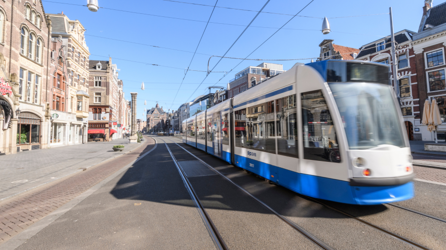
Whether your city’s preferred mode of public transit is a bus, trolley or cable car, anything that travels above ground — and in the same lanes as personal vehicles — becomes part of the traffic problem. Sooner or later, people will start viewing public transit, which should be a helpful resource, as a nuisance.
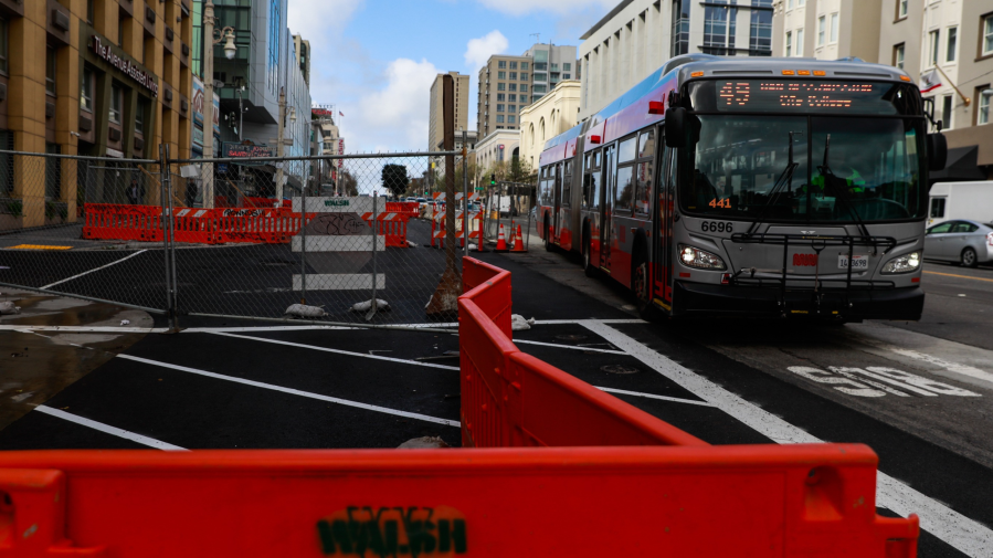
However, there are ways to increase public transportation mobility. Some cities are already implementing these ideas. San Francisco recently completed its designated bus lanes on Van Ness Avenue, one of the city’s major — and often traffic-clogged — arteries. So, have these bus-only lanes actually helped the flow of traffic?
“Travel-time savings were as high as 35% northbound, or nine minutes per trip, and 22% southbound, compared to a 2016 baseline that predates the recent construction disruption on the boulevard,” the San Francisco Examiner reports. “Depending on the time of day, roundtrip travel times for the 49 bus along the improved stretch of Van Ness decreased between 29% and 23%.”
Needless to say, rapid-transit corridors like this one suggest that getting cars out of public transit’s way is a plus for all involved. But that’s not the only game-changing idea we could implement going forward. There’s also the Dutch method, which allows public transit to get traffic light priority. The goal? Reduce traffic signal-based delays. In the Netherlands, all other vehicles stop when a streetcar, bus or tram approaches the intersection. To make things more seamless, Dutch traffic engineers have optimized the lights to ensure that vehicles, bicycles and pedestrians aren’t delayed too much, all while encouraging folks to use public transportation.
When there’s less congestion and fewer cars taking up parking spaces, lots and garages, people can easily access businesses. Smart Cities Dive states that business sales increase by $30 million for every $10 million put into transit investment, for example.
But city-based businesses aren’t the only ones benefiting from this type of investment. Rural communities could be better preserved; providing access to larger towns and cities to folks in less developed areas can both improve economic efficiency and allow people access to the services they need — but often can’t receive where they live. For example, if you live in a rural community that has easy access to robust and reliable public transit, you can make a medical appointment at a facility that’s further away.
As of now, a lot of transit funding gets poured into new highways that actually divert people from small, rural towns. Instead of building new roads, federal transportation policies that focus on repairing bridges and vital roads could help us all be better connected.
How Do Bicycles and Pedestrians Figure Into Urban Planning?
When public transportation, bicycles and pedestrians all have the dedicated lanes and spaces they need, the whole city — not just the people living there — benefits. Apart from reducing road congestion, a more mobile and accessible public transit system, — along with bike and pedestrian mobility — provides economic benefits, too.

When cities become less car-centric and focus on other means of transportation, people will be more than happy to travel on foot, or by bike, train or bus. Sidewalks and other pedestrian networks promote tourism by allowing people to visit local shops instead of just the big-name stores and hubs. Improved biking infrastructure goes a long way as well. Dedicated bike lanes, complete with separation buffers, and paved shoulders make cycling safer. Not to mention, more bike parking encourages people to leave their cars at home.
Walking and cycling also come with health benefits, of course — and not just on a personal fitness level. Fewer cars on the road means less smog and emissions, which is a win for the environment and our cities’ air quality. “Our cities are in the midst of an air quality crisis,” the Institute for Transportation & Development Policy notes. “According to the World Health Organization (WHO), 80% of urban residents are breathing air that does not meet standards for health.” Moreover, middle- and low-income nations — and neighborhoods — often suffer from the highest exposures to these pollutants.
All of this said, changing our approach to urban planning is a must. After all, improving public transportation’s efficiency and making our cities more walkable and bike-able has numerous pros. For starters, these improvements can increase accessibility; spur economic growth; connect our rural and urban communities more effectively; and help cut down on the negative effects personal vehicles have on the environment. While it may seem like a tall order, it is possible — and worth investing in. After all, cities around the world have already provided some great blueprints.


